
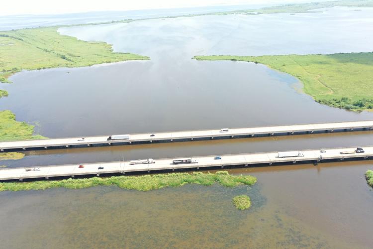


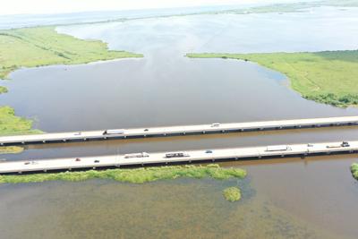
Drivers crossing the Interstate 10 bridge from Kenner to LaPlace will get an up-close view of how the state is rebuilding the coast later this summer. Sediment will be dredged from Lake Pontchartrain and pumped by pipelines to fill about 3 square miles of open water to restore a large chunk of the LaBranche Wetlands.
Also visible — construction of nearly 2½ miles of new rock breakwater along the lake’s edge, the latest in a series of breakwater projects aimed at protecting LaBranche from erosion by waves and hurricane surge.
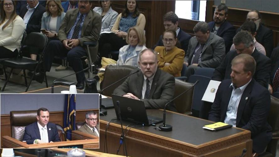
“When most people think about our marsh creation projects, they think we do it in remote areas of the coast,” said Andrew Beall, chief of project management for the state Coastal Protection and Restoration Authority.

Andrew Beall, chief of proect management, and Travis Moore, LaBranche Wetlands breakwater project manager, brief the Coastal Protection and Restoration Authority board on the wetland and breakwater projects in March 2023. (Louisiana Legislature)
The LaBranche East marsh restoration project will be the latest of several under construction in St. Charles and St. James parishes that will be much more visible to the public, said Jessica Diez, a CPRA project manager.
Other projects include construction of the West Shore Lake Pontchartrain hurricane levee and, on that levee’s upriver side, the Maurepas Swamp freshwater diversion.
“There’s going to be significant activity in this area that will not only be seen by folks coming in and out on I-10, but you’ll be able to see them from River Road, from Airline Highway, and, critically, from airplanes on the flight path coming in and out of New Orleans International Airport,” she said.
Increasing fish and wildlife habitat quality
The $56.9 million LaBranche East project calls for dredging 6.1 million cubic yards of sediment from the bottom of Lake Pontchartrain — enough to fill the Caesars Superdome 1½ times — and using pipelines to fill a major open water area on the north side of I-10, and small and large open water areas on the south side of the highway bridge.
The pipeline will have to be routed through a protective casing to stretch under the interstate bridge and a bridge on the Illinois Central Railroad, Diez said.
The project calls for pumping in enough sediment in each area to reach an elevation of about 3 feet above the lake’s surface level. Over time, the sediment will settle to become a freshwater/brackish marsh.
Each of the new marshes will also include a total of 39 tidal ponds, rectangular pools dug to 5 feet aimed at enticing the growth of submerged aquatic vegetation that is favored by migratory waterfowl. Several creeks also will be built to connect the ponds and assist in a “natural” flow of water through the rebuilt wetlands.

This map shows the locations of past and present Labranche Wetlands marsh restoration and lakefront breakwater projects, and their funding sources. Bayou LaBranche wetland creation was completed in 1994. (Coastal Protection and Restoration Authority)
“This project creates the largest tract of contiguous, ecologically critical Lake Pontchartrain fringe marsh to help diversify and directly sustain one of our largest and most important estuaries,” Diez said, in describing the project during a May meeting of the coastal authority.
“It exponentially increases the fish and wildlife habitat quality of the LaBranche Wetlands, due to its proximity to the original Bayou LaBranche marsh creation project and the LaBranche shoreline protection projects,” she said.
Initial work on designing the wetland areas will begin later this summer, along with the placement of the pipeline. Actual dredging should begin in early 2024, and continue through late spring.
History of LaBranche Wetlands
The LaBranche Wetlands have a history going back about 9,000 years, beginning when Lake Pontchartrain was originally formed, and including periods when the course of the Mississippi River shifted west 2,000 years ago to form what is now the Bayou Lafourche land mass, and then shifted back east to near its present path about 1,000 years ago, according to a 1993 ecological review of the area by Coastal Environments Inc.
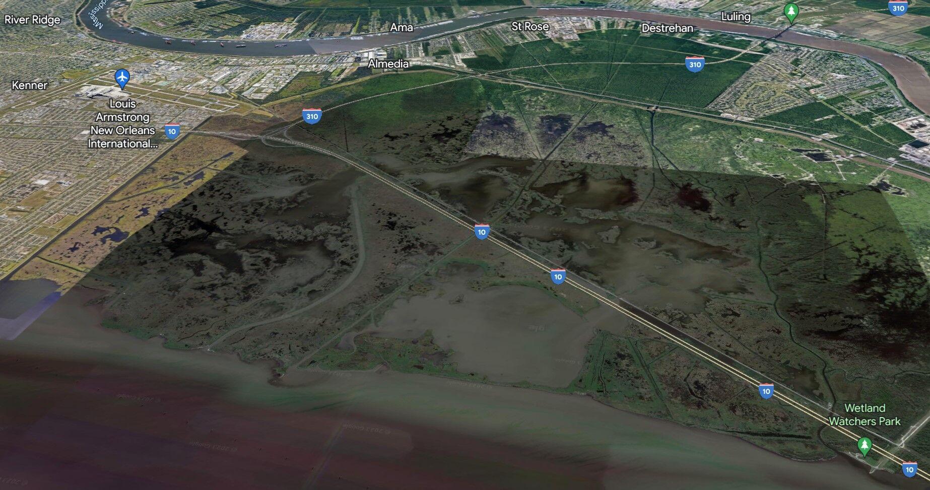
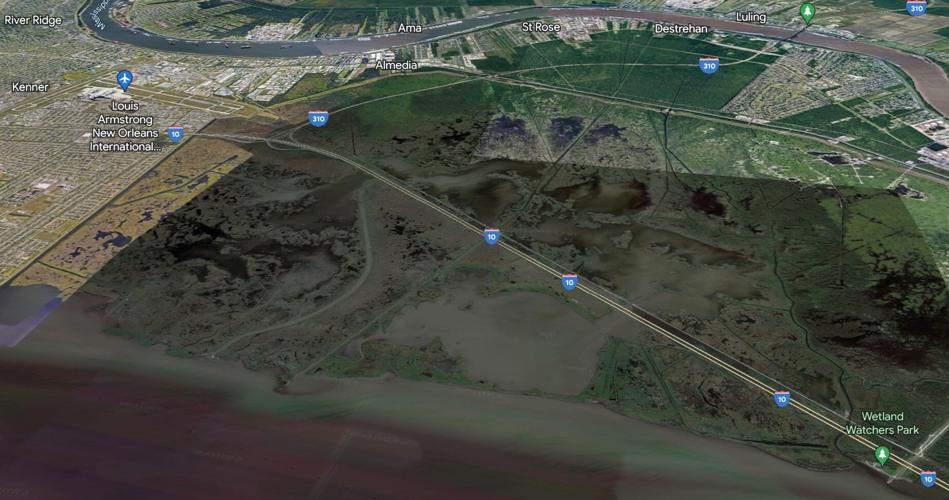
Aerial view of the LaBranche Wetlands shows how the filling of open water areas on both sides of Interstate 10 will be visible to drivers, and also to air passengers landing at Louis Armstrong New Orleans International Airport. (Google Earth)
After that last shift, Bayou LaBranche actually stretched from its present mouth adjacent to the Wetlands Watchers Park on the lakefront south and a bit west into what’s now the Bonnet Carre Spillway to near the natural levee of the Mississippi River.
During that last period, repeated river crevasses near what’s now the spillway provided a rich flow of river sediment that helped build the wetlands.
Around the time of New Orleans’ creation in 1718, French explorers were taught by indigenous tribes then living along the river to use the bayou as a secondary overland portage path to reach the river. The main portage was Bayou St. John, in the center of what’s now New Orleans.
According to a history included in the Coastal Environments study, the wetlands were named for the family of Louis LaBranche, a sugar planter who put together several plantations along the river whose southern edges included the wetland area. LaBranche died in 1843, and the plantation lands changed hands a number of times until they were bought by John Dresser in 1905, and then sold two months later to the North Louisiana Land Company, which was owned by Edward Wisner, best known now for the numerous land parcels he bought in south Louisiana that became the Wisner Trust.
Wisner attempted to develop the swamp land for farming by building canals and a pumping station, adding swampland along the lakefront in 2010 and calling it all LaBranche wetlands.

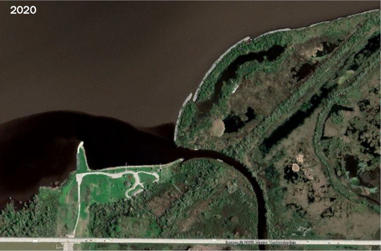
Aerial view of the mouth of Bayou LaBranche, adjacent to Wetland Watchers Park in St. Charles Parish. Sediment was pumped behind the breakwater to improve marsh creation, but sediment also has entered that area during openings of the nearby Bonnet Carre Spillway, officials say. (Coastal Protection and Restoration Authority)
The next year, Wisner tried selling off swamp parcels as truck farms. He died in 1915. That September, the Category 3 Hurricane of New Orleans made a direct hit on the city, and its storm surge — more than 8 feet high in some places — washed away the few low earthen levees that had been protecting the nascent farmland from the lake.
Wisner, and then the company that succeeded his death failed to sell much of the swampland to farmers. A few years later, much of the land eventually ended up in the hands of Frank J. Monteleone, whose family owns the Monteleone Hotel in New Orleans.
Wetlands stress began almost 200 years ago
The wetlands already were stressed by the blockage of water flow across the vast land mass by the construction of what’s now the Illinois Central Railroad, beginning in the 1830s.
Add shoreline erosion, soil compaction and subsidence, construction of a variety of oil, gas and other petrochemical product pipelines, and then the canals dug to extend Interstate 10 from New Orleans to Baton Rouge, and it’s not hard to understand why open water areas along the lake shoreline and in the wetland interior have grown.
In 1990, Congress created the Coastal Wetlands Planning and Protection Act, which uses a share of sales taxes from the sale of fuels for lawn mowers and tractors for small grants.

Coastal Protection and Restoration Authority project workers look at one of several duck blinds that will be removed from open water where sediment will be deposited to rebuild part of the LaBranche Wetlands. (Nick Gremillion, Coastal Protection and Restoration Authority)
The first list of projects proposed under the new law included one to restore part of the wetlands adjacent to the Bayou LaBranche’s mouth. That $3 million project used 2.5 million cubic yards of sediment dredged from the lake to build a marsh platform that is still in place.
The new project was first proposed under wetlands protection law in 2009, and is being built under the leadership of the CPRA and the U.S. Agriculture Departments Natural Resources Conservation Service.
The new shoreline breakwater will cost $21.3 million, with the money coming from state budget surplus funds. The breakwater will take advantage of lessons learned from three earlier projects that built 3.6 miles of breakwater along parts of the shoreline.
A key lesson, said project manager Travis Moore, is the use of lightweight bags of aggregate rock as a base for heavier boulders, which has been found to reduce subsidence caused by the weight of the rocks.