
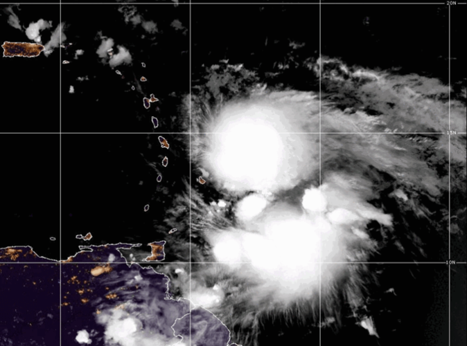
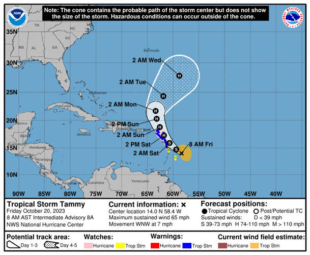

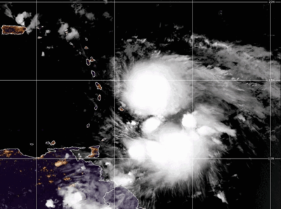
Tropical Storm Tammy is expected to reach hurricane strength this weekend as it turns north over the Leeward Islands, according to the National Hurricane Center.
Located about 90 miles northeast of Barbados, Tammy was producing sustained winds of 65 mph and moving west-northwest at 7 mph Friday morning, hurricane forecasters said. The storm is expected to reach hurricane status Saturday while it moves near or over parts of the Leeward Islands.
Heavy rain and high winds are expected in the Leeward and northern Windward islands Friday, spreading into the U.S. Virgin Islands and Puerto Rico over the weekend.
Flash flooding and isolated mudslides are possible, forecasters said.
A hurricane watch is in effect for Guadeloupe, Antigua, Barbuda, Monserrat, St. Kitts, Nevis, Anguilla, St. Maarten, St. Martin and St. Barthelemy. A tropical storm warning was issued for Nevis, Saba and St. Eustatius and a tropical storm watch is in effect in Barbados and Martinique.

Friday's forecast showed the storm turning north and then slightly east later this week, moving away from the Gulf of Mexico as so many systems have this season.
Hurricane forecaster first started tracking Tammy as a tropical wave off the coast of Africa and it formed as a tropical storm on Wednesday.
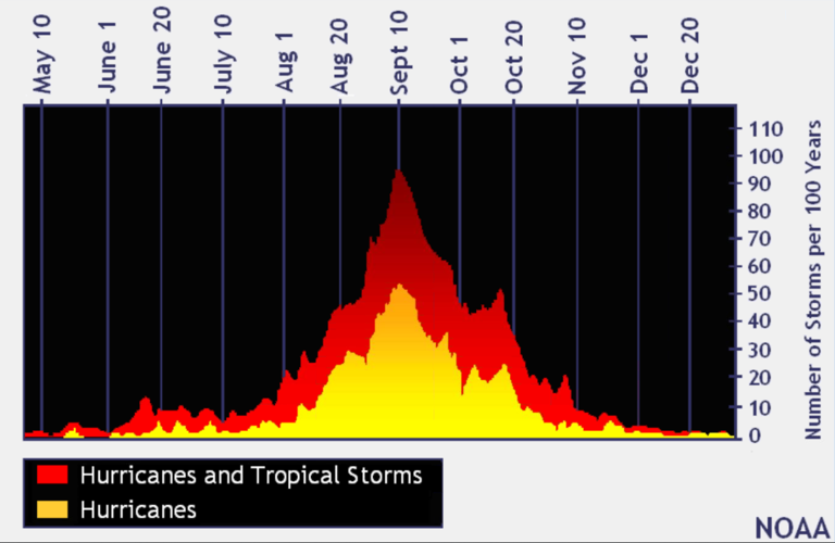
The busiest time of hurricane season
We've officially entered what is historically the most active period of the Atlantic hurricane season, so consider this your reminder to get prepared and stay vigilant.

In the last 100 years, the tropics have been the most active in August, September and October, with Sept. 10 being the peak of the Atlantic hurricane season, according to federal forecasters. (graphic via NOAA)
In the last 100 years, the tropics have been busiest from mid-August through October, with Sept. 10 being the peak of the season, according to federal forecasters. About 80% of the systems that have hit the Gulf Coast formed during this time, according to the National Weather Service in Slidell.
The 2023 hurricane season
The return of El Niño was initially expected to bring a wetter second half of the year to Louisiana and a reduced risk of hurricanes.
The National Oceanic and Atmospheric Association's Climate Prediction Center announced March 9 that La Niña, which usually causes more hurricanes to form in the Atlantic, was officially over after an unusually long three years.
El Niño and its sister La Niña are part of the El Niño-Southern Oscillation cycle, a set of conditions over the Pacific Ocean that affects weather patterns across the world. In Louisiana, the biggest effects involve hurricane season in the Atlantic Ocean.
Regardless, this year's first cyclone hit in January, long before the official start of hurricane season, and June alone saw three named storms. Now forecasters are predicting that 2023 will prove to be an above-average hurricane season, with 18 named storms.
The first tropical storm to form in the Atlantic this year was named Arlene, reaching wind speeds of 40 mph on June 2 as it headed for Cuba. Don was the first storm to reach hurricane status in 2023, producing maximum sustained wind speeds of 75 mph on July 22 before rapidly weakening to a tropical storm the following day.
The next storm to form will be named Vince. Here's the full list of this year's storm names.
Don't miss a storm update this hurricane season. Sign up for our free Hurricane Center newsletter.